Ərəfsə (Arafsa)
Ərəfsə (also, Arafsa and Aravsa) is a village and municipality in the Julfa District of Nakhchivan, Azerbaijan. It is located 55 km in the north from the district center, on the right bank of the Alinjachay River, on the slope of the Zangezur ridge. Its population is busy with vine-growing, grain-growing and animal husbandry. There are a secondary school, a cultural house, two libraries, a communication center, and a medical center in the village. It has a population of 940.
There exist the Daş Körpü and the Xarabalıq settlements of the Middle Ages in the north-east from the Arafsa village.
The name of the Arafsa village is related with the name of Turkic ərəfsəli (arafsali) tribe. They were one of the branch of the Turkic Kengerli. Some sources of the 18th-19th centuries mention the name of ərəfsəli generation among Kengerli tribes living in the Nakhchivan. During the rule of the Iranian ruler Nadir Shah Afshar (1736-47), from the administrative aspect ərəfsəli tribes were ruled by the lawyers and elders who came out from the among own tribes in Nakhchivan. Ərəfsəli tribes who lived in a series of villages of Nakhchivan and Daralayez uyezd were engaged in cattle-breeding. The name of the Ərəfsəli (Arafsali) village of the Sisian province of Armenia also is related from the name of the ərəfsəli tribe.
As it is located near the border with Armenia, it has also been referred to in Armenian literature as Arevek (Արեւէք).
Map - Ərəfsə (Arafsa)
Map
Country - Azerbaijan
 |
 |
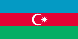
| Flag of Azerbaijan | |
The Azerbaijan Democratic Republic proclaimed its independence from the Transcaucasian Democratic Federative Republic in 1918 and became the first secular democratic Muslim-majority state. In 1920, the country was incorporated into the Soviet Union as the Azerbaijan SSR. The modern Republic of Azerbaijan proclaimed its independence on 30 August 1991, shortly before the dissolution of the Soviet Union in the same year. In September 1991, the ethnic Armenian majority of the Nagorno-Karabakh region formed the self-proclaimed Republic of Artsakh. The region and seven surrounding districts are internationally recognized as part of Azerbaijan pending a solution to the status of the Nagorno-Karabakh through negotiations facilitated by the OSCE, although became de facto independent with the end of the First Nagorno-Karabakh War in 1994. Following the Second Nagorno-Karabakh War in 2020, the seven districts and parts of Nagorno-Karabakh were returned to Azerbaijani control.
Currency / Language
| ISO | Currency | Symbol | Significant figures |
|---|---|---|---|
| AZN | Azerbaijani manat | ₼ | 2 |
| ISO | Language |
|---|---|
| HY | Armenian language |
| AZ | Azerbaijani language |
| RU | Russian language |


